Austria – key data
Area: 83,871 km² (of which land: 82,445 km², water: 1,426 km²)
Population: 8.2 million (July 2011 estimate, CIA). Composition: Austrians 91.1%, former Yugoslavs 4% (mainly Croats, Slovenes, Serbs and Bosniaks), Turks 1.6%,German 0.9%, others 2.4% (2001 census).
Population density: 98 residents per km²
Population growth: 0.034% per year (2011, CIA)
Capital city: Vienna (1.69 million residents, 2009, metropolitan area around 2.3 million residents, 2007)
Highest point: Grossglockner, 3,798 m
Lowest point: Lake Neusiedl, 115 m
Form of government: Austria has been a parliamentary-democratic federal republic since 1918. The constitution dates from 1920. The Austrian bicameral parliament is made up of the Federal Council (64 MPs) and the National Council (183 MPs) together. The Austrian Federal President is elected every six years. The members of the National Council are elected every 4 years. The members of the Federal Council are appointed by the state parliaments. Austria has been a member of the European Union since 1995.
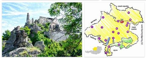
Administrative division: 9 federal states: Burgenland, Carinthia, Lower Austria, Upper Austria, Salzburg, Styria, Tyrol, Vorarlberg and Vienna.
Head of State: Federal President Heinz Fischer, since July 8, 2004
Head of Government: Federal Chancellor Werner Faymann, since December 2, 2008
Language: the official language in Austria is German (88.6% of the population). Turkish 2.3%, Serbian 2.2%, Croatian 1.6%, others 5.3% (2001 census).
The Burgenland Croatians, Slovenes and Hungarians have the right to speak to the authorities in their mother tongue. In the administrative and judicial districts of Carinthia, Styria and Burgenland with Slovene, Croatian or mixed populations, Burgenland-Croatian and Slovene are further official languages. In several Burgenland municipalities, Hungarian is an official language with equal rights. The language of the Roma, Romanes, as well as Czech and Slovak are nationally recognized minority languages in Austria. In addition, Austrian sign language is constitutionally recognized.
Religion: Roman Catholic 73.6%, Protestant 4.7%, Muslim 4.2%, other 3.5%, no information 2%, no religion 12% (2001 census).
Local time: CET. Between the last Sunday in March and the last Sunday in October there is summer time in Austria (CET + 1 hour).
The time difference to Central Europe in both winter and summer 0 h.
International phone code: +43
Internet identifier:.at
Mains voltage: 220 V, 50 Hz
The Republic Austria is a landlocked country in Central Europe and borders Germany in the northwest, the Czech Republic and the Slovak Republic in the northeast, Hungary in the east, Slovenia and Italy in the south and Switzerland and Liechtenstein in the southwest. The Austrian territory covers a total area of 83,850 square kilometers and extends from west to east between Lake Constance and Lake Neusiedl over 573 kilometers.
The country is predominantly dominated by low and high mountain ranges; The Eastern Alps alone take up almost two thirds of the entire Austrian territory. A quarter of the country is occupied by flat and hilly land, which stretches to the south with varying widths along the Danube, in the Vienna Basin with the Weinviertel and on the eastern edge of the Alps. Visit rctoysadvice for Austria Tour Plan.
The Austrian Alps are divided into three mountain ranges: the Limestone Alps in the north, the Central Alps and the Limestone Alps in the south. The northern Limestone Alps extend from the Rätikon over the Lechtal Alps, the Karwendel, Kaiser and Tennen Mountains over the Eisenerzer Alps to the Schneeberg. Since they are repeatedly cut by rivers, the northern Limestone Alps do not form a continuous mountain range. They are predominantly characterized by rugged peaks and karstified high plateaus. The Central Alps range from the Ötztal Alps to the Hohe Tauern and the Niedere Tauern. Huge mountain ranges covered with glaciers and deep valleys carved out by ice dominate this massif, which has the highest mountain in Austria, the Grossglockner at 3,797 meters. The southern Limestone Alps are separated from the Central Alps by the Drau Valley. They have been the natural border between Austria and Italy and Slovenia since 1919.
Between the northern edge of the Alps and the Danube lies the Upper and Lower Austrian Alps, which slopes down to the north in expansive terraces and wooded heights. The northern Burgenland and the wine district are the only major levels of Austria, which are composed of Tullnerfeld, March Field, Seewinkel and other areas. The extremely fertile plains represent the country’s granary and its most important growing area for wine, fruit and vegetables. Lake Neusiedl separates this productive region from the Puszta, which is interspersed with salt ponds. The hill country of Styria and southern Burgenland is already strongly influenced by the southern climate, which benefits the cultivation of fruit and grain. Forests, meadows and vineyards also determine the landscape of this region of Austria.
The Danube is the country’s most important river, which also drains most of Austria to the Black Sea. Lake Neusiedl, located in Burgenland, is the largest lake in the country with a total area of 315 square kilometers. About 77% of its area is in Austria, the rest of the lake belongs to Hungary. It is followed by Attersee and Traunsee. Even Lake Constance lies with a small part on Austrian territory. The well-known but not very large lakes of Wörthersee, Mondsee and Wolfgangsee mainly play an outstanding role in the tourism sector.