| US 400 | |||
| Get started | Granada | ||
| End | Joplin | ||
| Length | 488 mi | ||
| Length | 785 km | ||
|
|||
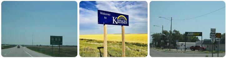
According to Ablogtophone, US 400 is a US Highway in the United States, located mostly in the state of Kansas, plus two more short stretches in the states of Colorado and Missouri. The road forms an east-west route through southern Kansas and is largely double -numbered with other US Highways, most notably US 50 and US 54. Most of the 785 kilometer route is double numbered with other roads.
Travel directions
The road begins in Colorado in the village of Granada, immediately double-numbered with US 50 in Colorado. It crosses US 385, which leads north to Burlington. The road then runs for about 15 miles to the Kansas border.
At the village of Coolidge, US 400 crosses the Kansas state border, paralleling the Arkansas River, a major tributary of the Mississippi. This area lies at an altitude of about 1000 meters and consists largely of treeless plains with meadows. This part of Kansas is sparsely populated, with only a few villages spanning tens to hundreds of miles. In the border area with Colorado, Kansas is very dry, but it gets a bit greener to the east. After about 110 kilometers you reach Garden City, with 28,000 inhabitants one of the largest places in western Kansas. Here one crosses the US 83, the road from McCook in Nebraskato Liberal in southwestern Kansas. There is a ring road around Garden City, so through traffic does not have to go through the town. After Garden City there is even a piece of 2×2 lanes, up to the Garden City Regional Airport.
The road then runs for about 50 miles through the prairies to Dodge City, one of the most prominent cities in the western half of Kansas with a population of 25,000. There is a bypass around Dodge City, and US 50 passes north of the city. US 400 exits here for a route further south to the city of Wichita. The road then runs on its own for about 50 kilometers until Mullinville, where the route merges with US 54 coming out of Liberal.
At Greensburg, a town that was razed to the ground by an EF5 tornado in 2007, US 183 crosses the road from Sitka to Hays. From time to time one crosses various main roads that actually only lead from villages to other villages, the distances are very large here. At Pratt you cross US 281, which runs from Medicine Lodge to Great Bend.
US 400 at Fredonia.
From the town of Kingman, US 54 becomes a 2×2 lane highway, which is 40 kilometers long. Just west of Wichita, the highway section is temporarily interrupted by some at -grade intersections, but in Wichita the road is a highway. The airport crosses Interstate 235, the city’s western ring road. The highway runs directly past the center and has 2×3 lanes here. A turbine interchange crosses Interstate 135, the state’s westernmost north-south Interstate. After this, the highway continues through the eastern residential areas of Wichita, and the highway portion ends at Interstate 35, the toll roadfrom Oklahoma City to Kansas City. Shortly thereafter, SR-96 ends at US 54, the city’s northern beltway. A little further on, between Augusta and Pickrell Corner is another highway section. Then US 54 turns north and US 400 continues straight to Parsons in the southeastern part of the state.
The road then starts its second individual route, of about 215 kilometers. It passes through a sparsely populated part of Kansas, and there are no larger towns or villages for 120 kilometers to Neodesha. At Neodesha one crosses US 75, after which US 400 runs as a Super Two for 20 kilometers to Morehead, where one crosses US 169. About 30 kilometers further, at the town of Parsons, you cross the US 59, the main road to Lawrence. The road then runs for 50 kilometers to the east, with a number of villages on the route. Just south of Pittsburg, the road merges with US 69 heading south. The US 160 also runs here from Independence to LamarMissouri. The road then follows Alternate US 69 to Baxter Springs, then merges with US 166 east. One then crosses the border with Missouri and arrives a few hundred meters from the tristate point with Oklahoma. One mile into Missouri, both US 400 and US 166 terminate at Interstate 44, the highway from Tulsa to St. Louis.
Road number
The US 400 is a violation of the numbering system, as it should be an auxiliary route of the US 0, which does not exist.
History
US 400 was assigned to run along a corridor for a potential route of Interstate 66, which today runs only into Virginia and the District of Columbia. There were even ideas for an extension to California, but this plan has been canceled west of Wichita due to lack of interest and very low traffic volumes. US 400 was intended as a temporary route until I-66 was built. It will be years before I-66 is built, if at all.